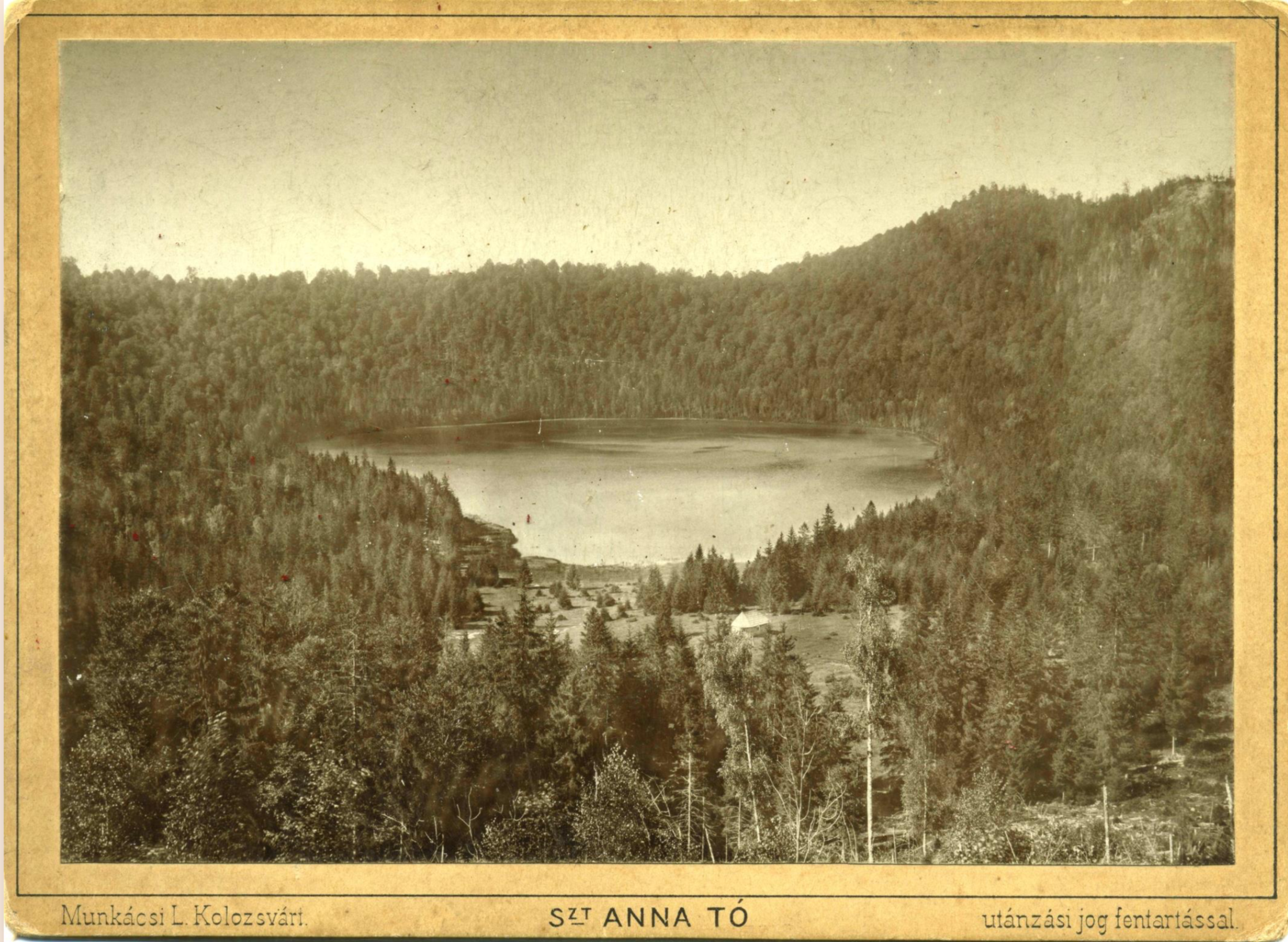
Lake Saint Anne is one of the most attractive sights in Szeklerland and the only entirely preserved volcanic lake in southeastern Europe. It is located in one of the twin craters formed at the summit of Mount Csomád/Ciomat, a volcanic cone at the southern extremity of the Hargita/harghita volcanic mountain range, at 949–950 m above sea level. This pearl of Transylvania, besides being a breathtaking place to visit, has a beautiful legend about its origin as well.
Sándor Tamás and Hunor Boér have researched existing pictures, maps, panoramas, and postcards about Lake St. Anne issued before 1914. In an interview with TransylvaniaNOW, Tamás said they chose not to go further, because from 1914 onwards pictures multiplied, and those images are more likely available to more people than earlier representations of the lake.
Scientists say the volcano where the lake formed last erupted 28–29,000 years ago, and that the lake is about 10,000 years old. The southern edge of Lake Saint Anne’s crater was mentioned for the first time in a stakeout document (concerning the Mikó family’s assets) from 1349, in which so-called Toberch (Tóbérc), the mountain crest separating Csík County from Háromszék first appears as a toponym. This document was published in the Székely Oklevéltár’s first volume. According to the joint research of Tamás and Boér, the first description of the lake and the first mention of the name of St. Anne is to be found in a 1696 manuscript authored by a Csíkkozmás priest, István Lakatos, who also createda manuscript map of Szeklerland on which, for some reason, the lake doesn’t appear.
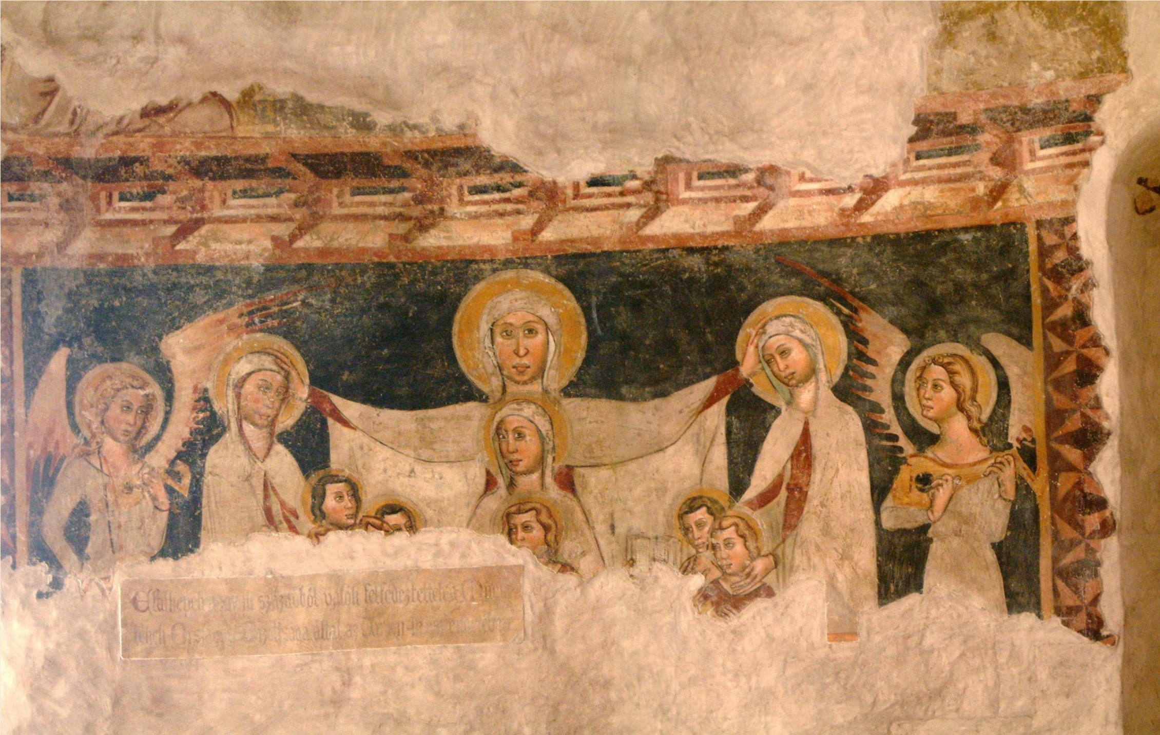
The cult of St. Anne is very strong in Szeklerland. The earliest depiction we have knowledge of is on a fresco from the fourteenth century located in the medieval church of Marosszentanna/Santana de Mures. This fresco is among the first in Europe showing St. Anne, according to Sándor Tamás. But we find other frescos in Csíkszentgyörgy/Ciucsângeorgiu, Csíkszenttamás/Tomeşti, Csobot-hegy, Kadicsfalva/Cădişeni, Hollósarka/Capu Corbului, Madéfalva/Siculeni, Nyárádszentanna/Sântana Nirajului, Székelybós/Bozeni, Tusnád/Tuşnad, Zsögödfürdő/Jigodin-Băi, Kézdimartonos/Mărtănuş, and Miklósvár/Micloşoara as well. According to apocryphal Christian and Islamic tradition, Saint Anne was the mother of Mary and grandmother of Jesus. In the glorious Middle Ages, St. Anne was fondly referred to as the Comfortress of the Sorrowing, Mother of the Poor, Health of the Sick, Patroness of the Childless, Help of the Pregnant, Model of Married Women and Mothers, Protectress of Widows, and Patroness of Laborers, which explains the strength of her cult in the region once known for its sulfur mines.
Lake St. Anne’s first appearance on a map dates from 1699. The lake appears in a hand-drawn Transylvanian atlas counting 21 pages, out of which 10 depict the Szeklerland region. It is worth noting that the locations’ names are written in Hungarian, so the man who created the map was likely a Hungarian. The maps are part of the Jesuit priest Gábor Hevenesi’s collection. Map historian Árpád Papp-Váry, says that the map is a copy of a Transylvania map authored by artificer officer Giovanni Morando Visconti in 1699. Whoever the author is, this is the first detailed map of the Szekler Seats and the first original site map in Hungarian cartography.

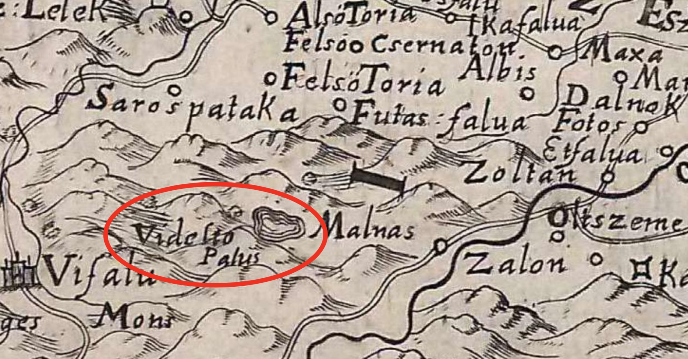
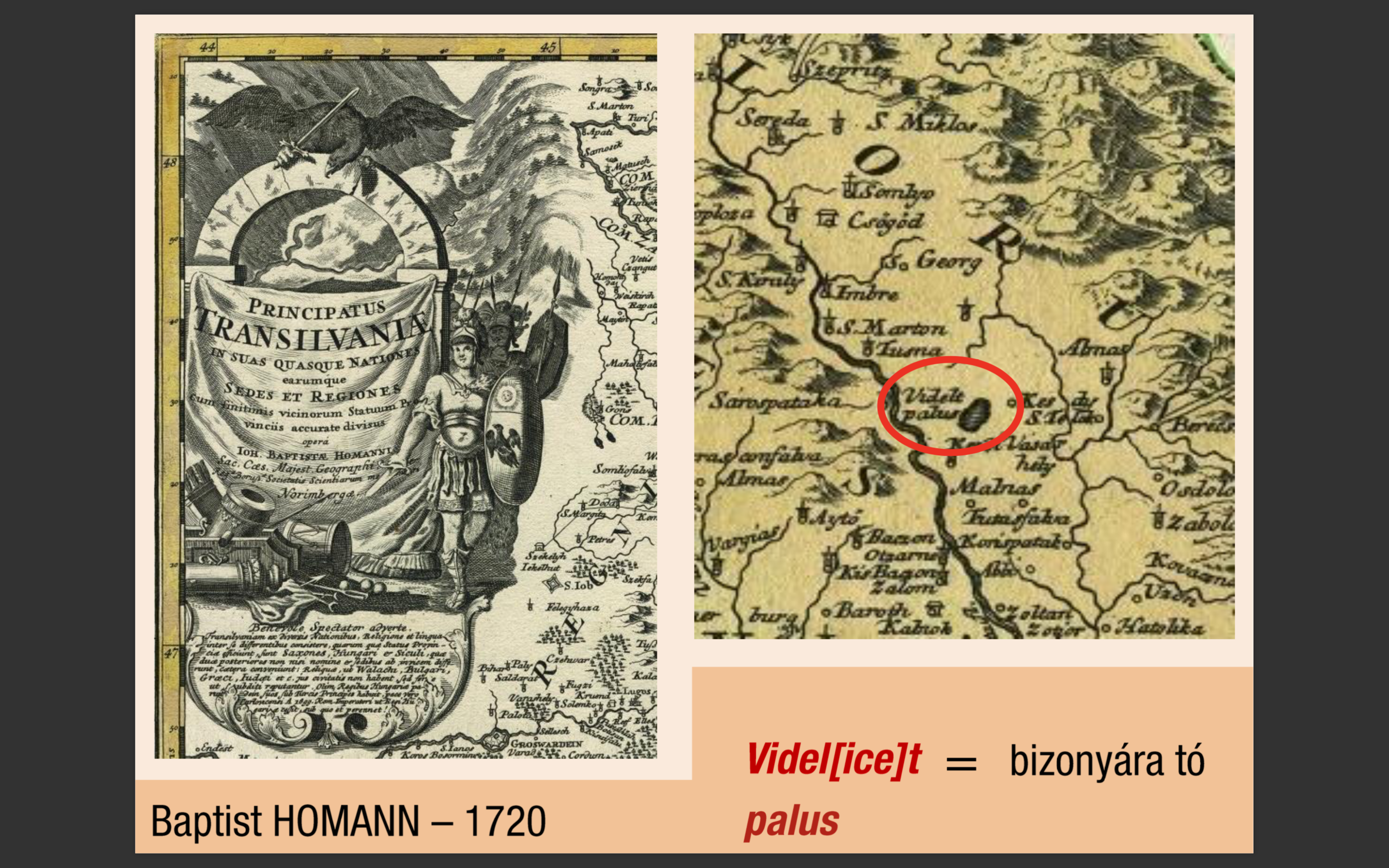
In terms of historical maps, the first to mention the lake is Giovanni Morando Visconti’s work on Transylvania from 1699. The author draws the lake on the map with the comment Videlto/Palus. Twenty-one years later, Johann Baptist Homann writes Videl[ice]t/palus, which means “certainly/clearly a lake”. On another map, however, he writes Videltapa/lus.
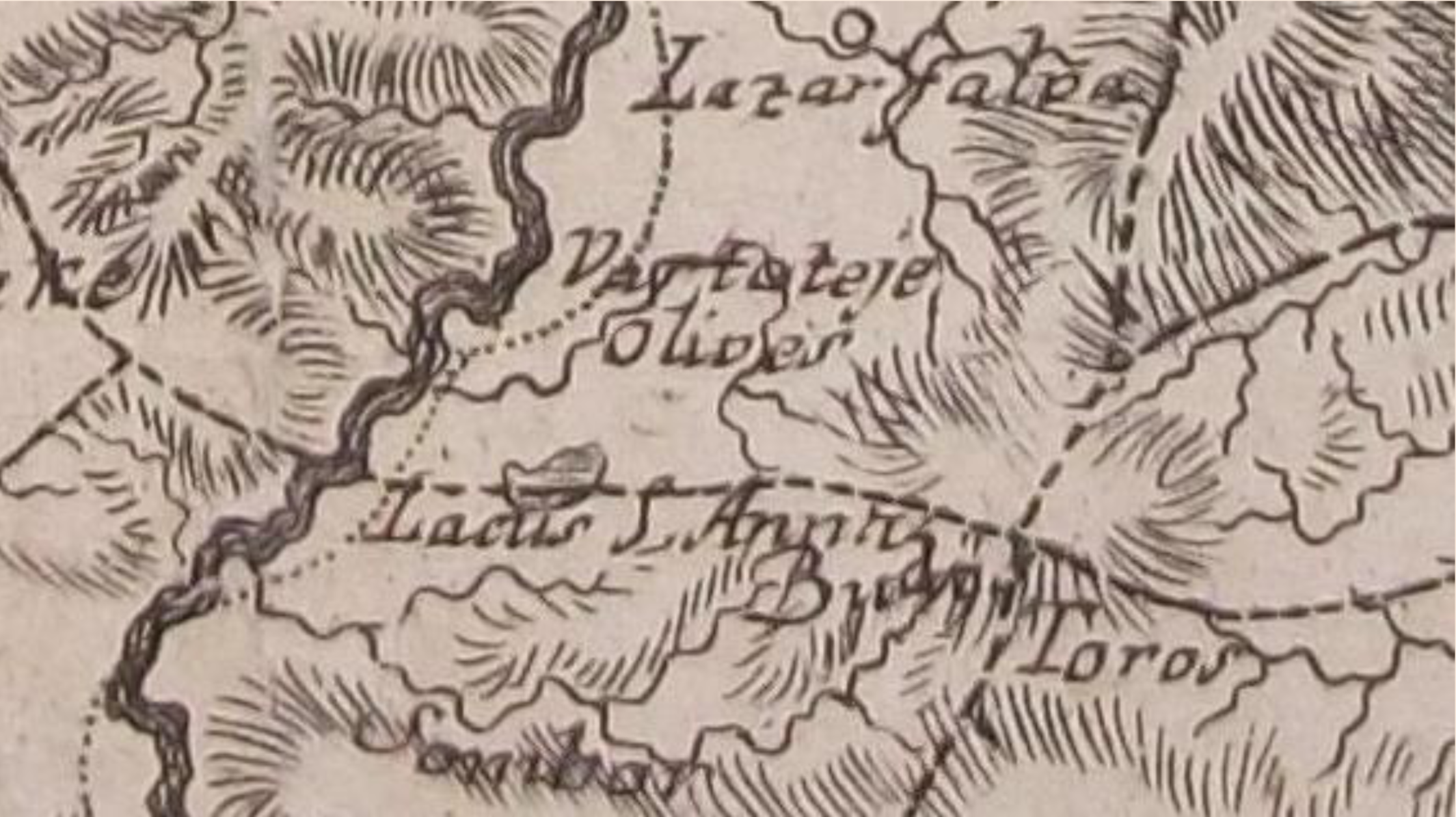
The first mention of the lake as Saint Anne (Szent Anna) is from 1769 on Ignaz Müller’s classified map. Twenty years later, Wenzely calles the lake S[ancta] Anna See. What makes this map particularly interesting is an error: according to the cartographer, the lake’s water flows into the Zsombor Creek [Schambor], which is untrue.
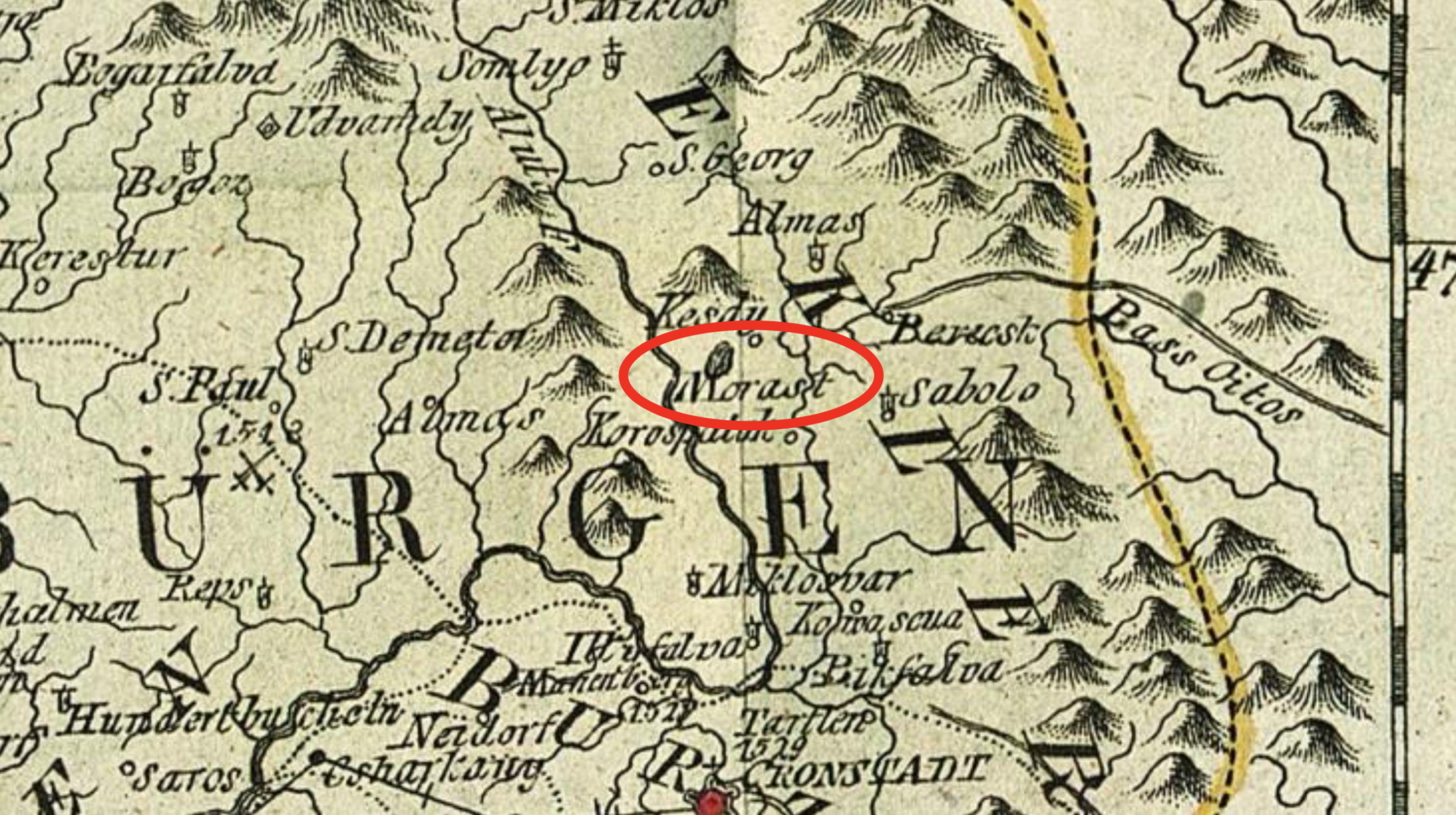
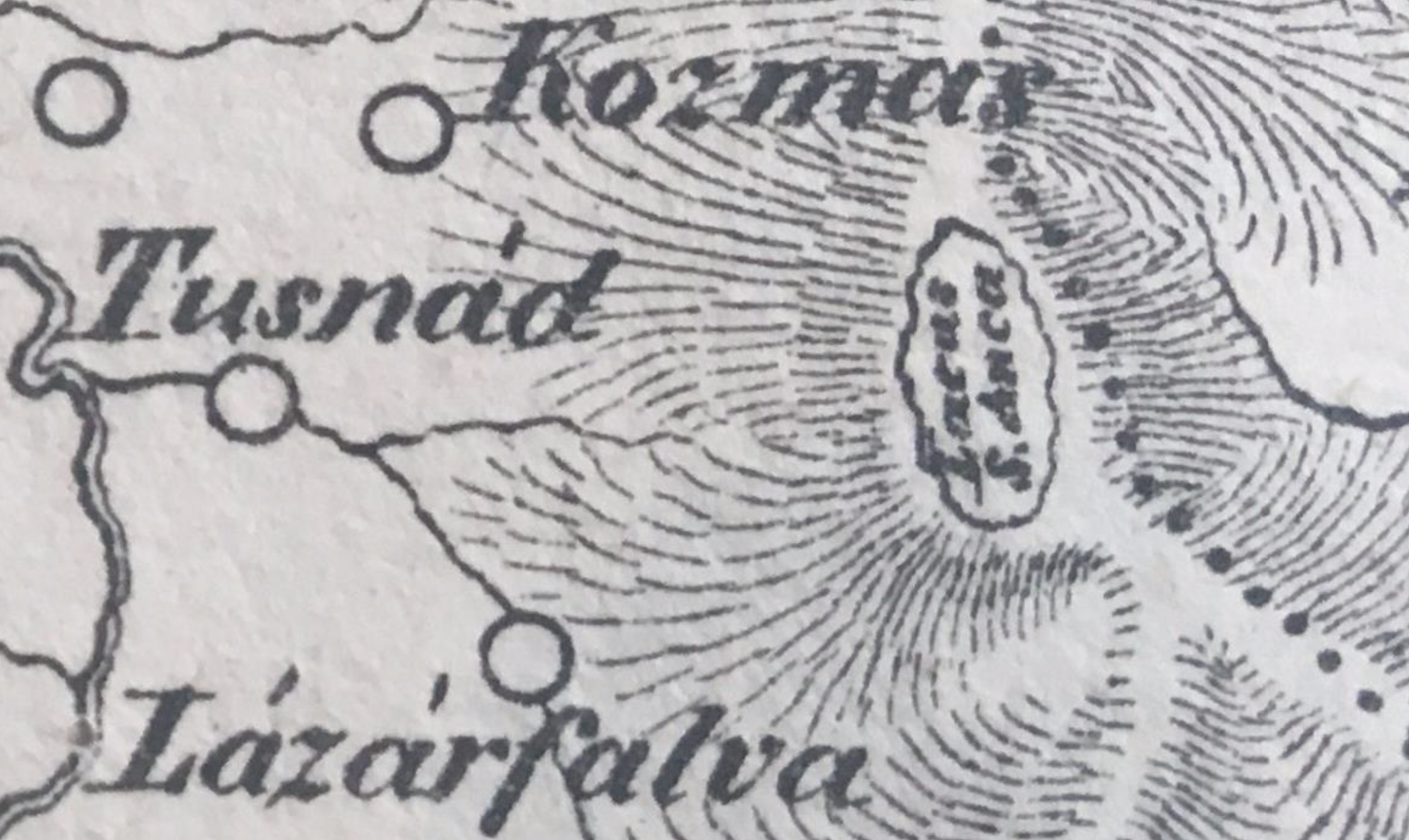
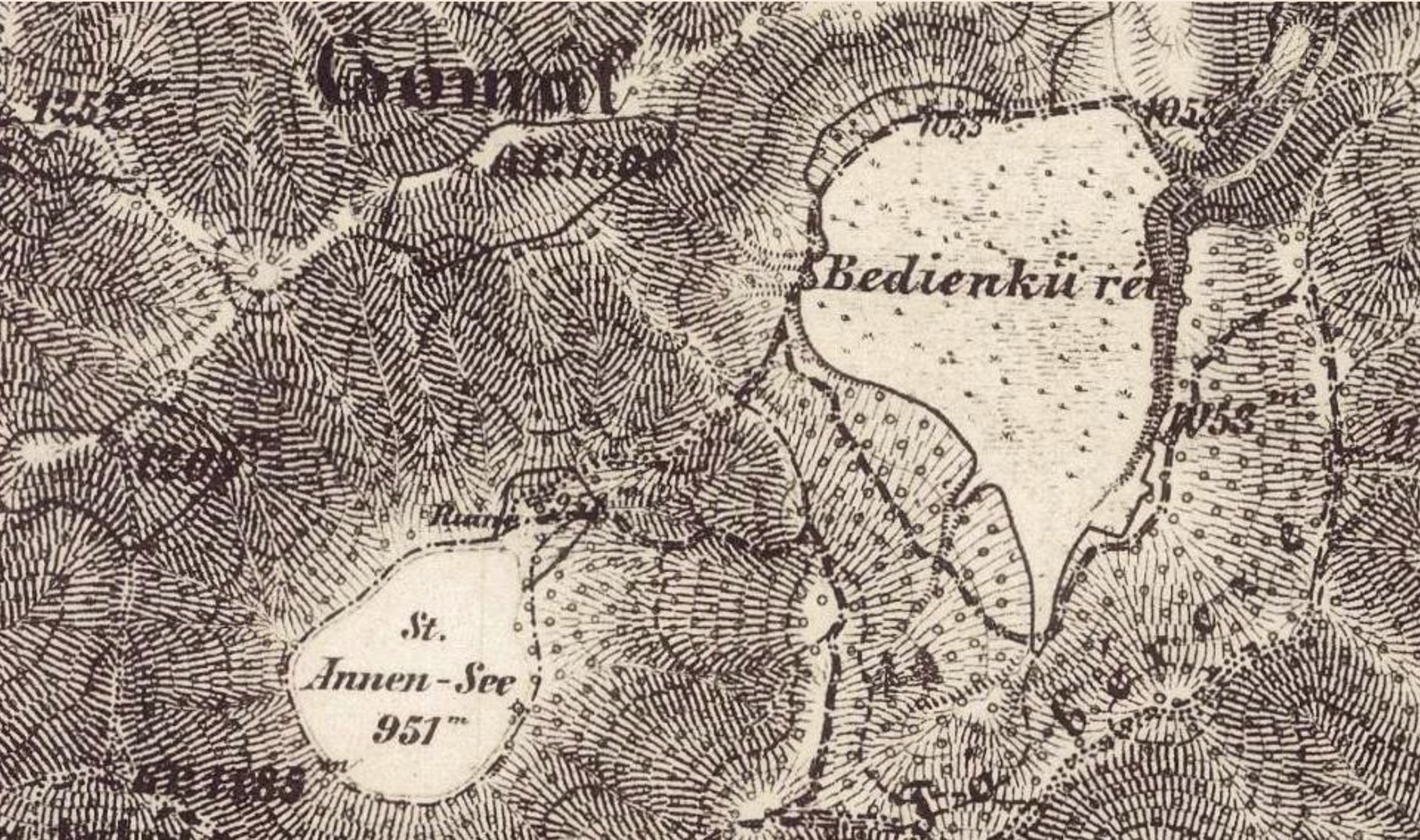
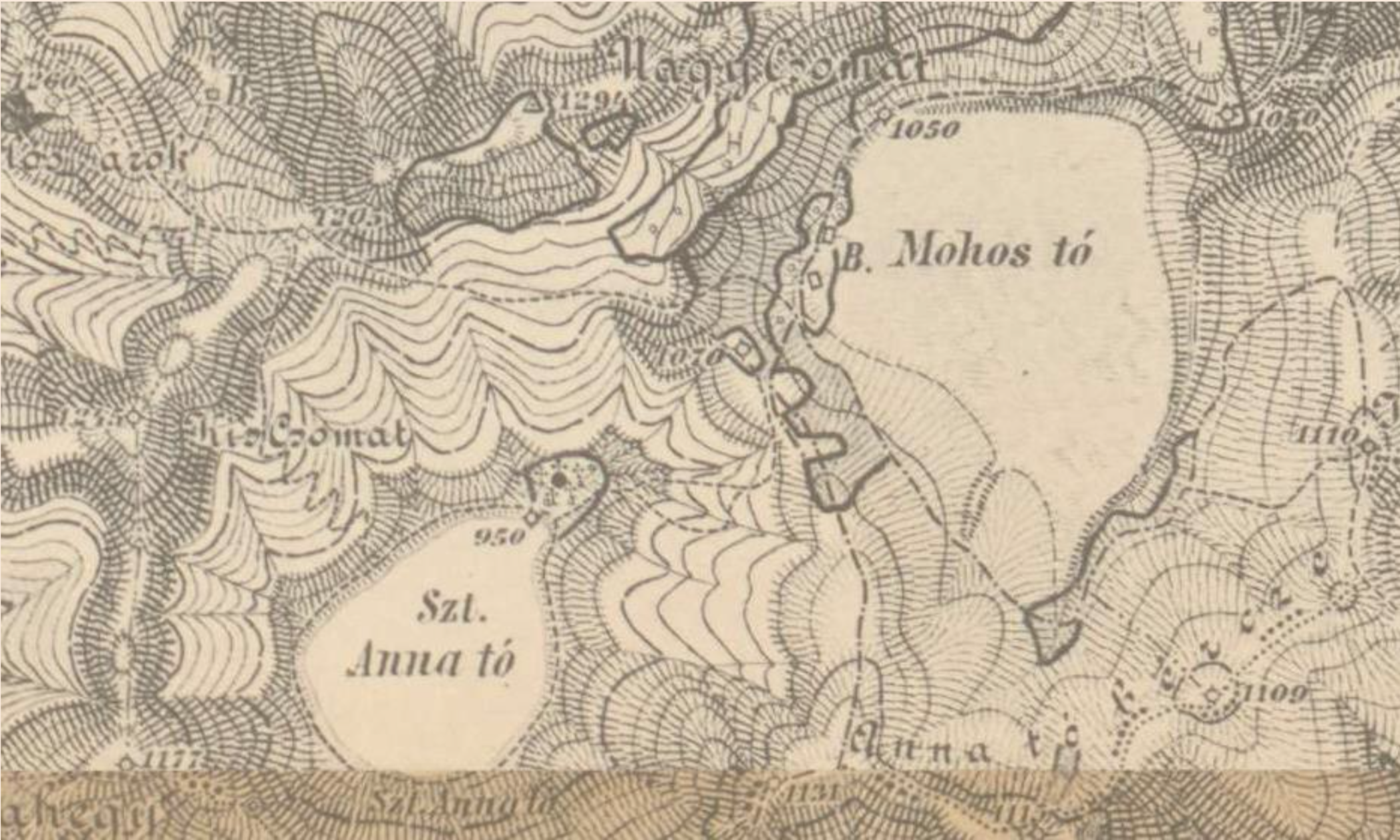
Austrian cartographer Franz Johann Joseph von Reilly, on the other hand, “degrades” the lake on two of his maps (1790 and 1804), as he labels it “Morast” or “Peat Bog”. Although this unflattering description was wrong, we know that there is a twin crater at an altitude of 100 meters above the crater of Saint Ana Lake, bordered by the Lake’s Edge, and at 1050 meters there is a filled peatland covering nearly 80 hectares. The Mohos peat bog is not only famous in the Carpathian Basin, but it is one of the most picturesque peat bogs in the world as well. The first modern monograph about Szeklerland (preceding Balázs Orbán’s work) written by Daniel Gottlieb Scheint, a Saxon doctor contains the first printed map of the region; the cartographer, however, erroneously places the “Lacus S[ancta] Anca” (Lake Saint Anne) atop the Nyerges-tető.
The survey proceeded from land to land and from province to province. It was to serve military purposes, and this entailed secrecy. Through its richness of detail and the sheer size of the area covered, the map, finished in 1787, was impressive. Twenty-one different surveys of countries and regions resulted in 3,324 sheets drawn at a scale of 1:28,800 and 275 sheets drawn at a scale of 1:11,520 (for the territory of the Austrian Netherlands). The map of Transylvania included 280 sections, each covering an area of 18 × 12 kilometers (11 × 7.5 miles).
The survey was to serve military purposes, and this entailed secrecy. Through its richness of detail and the sheer size of the area covered, the map, finished in 1787, was impressive. Twenty-one different surveys of countries and regions resulted in 3,324 sheets drawn at a scale of 1:28,800 and 275 sheets drawn at a scale of 1:11,520 (for the territory of Austrian Netherlands). The map of Transylvania included 280 sections, each covering an area of 18 × 12 kilometers (11 × 7.5 miles).
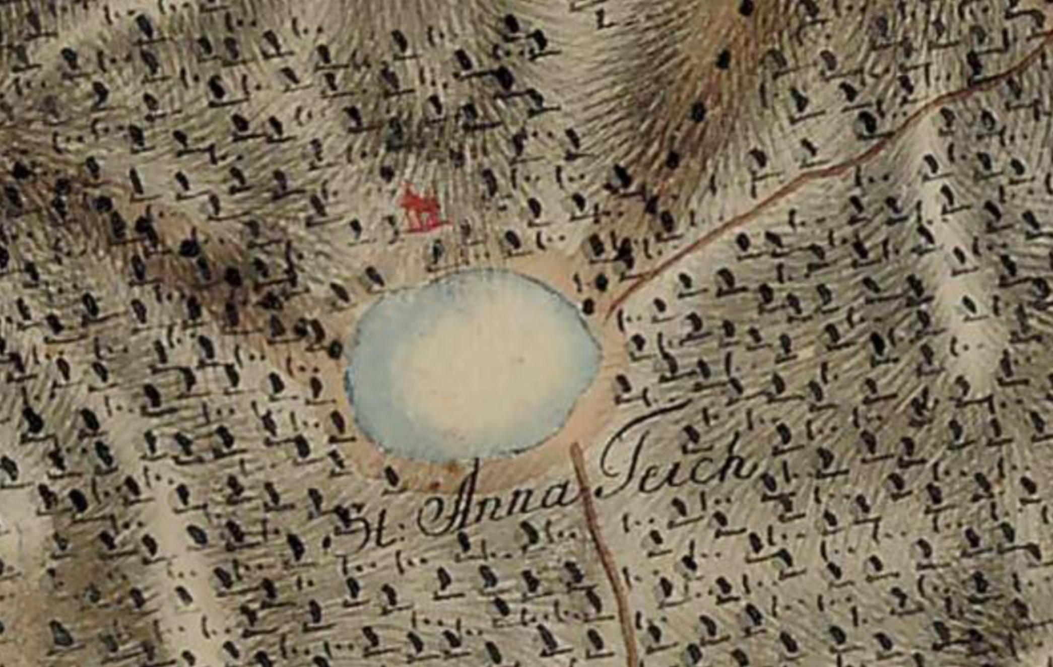
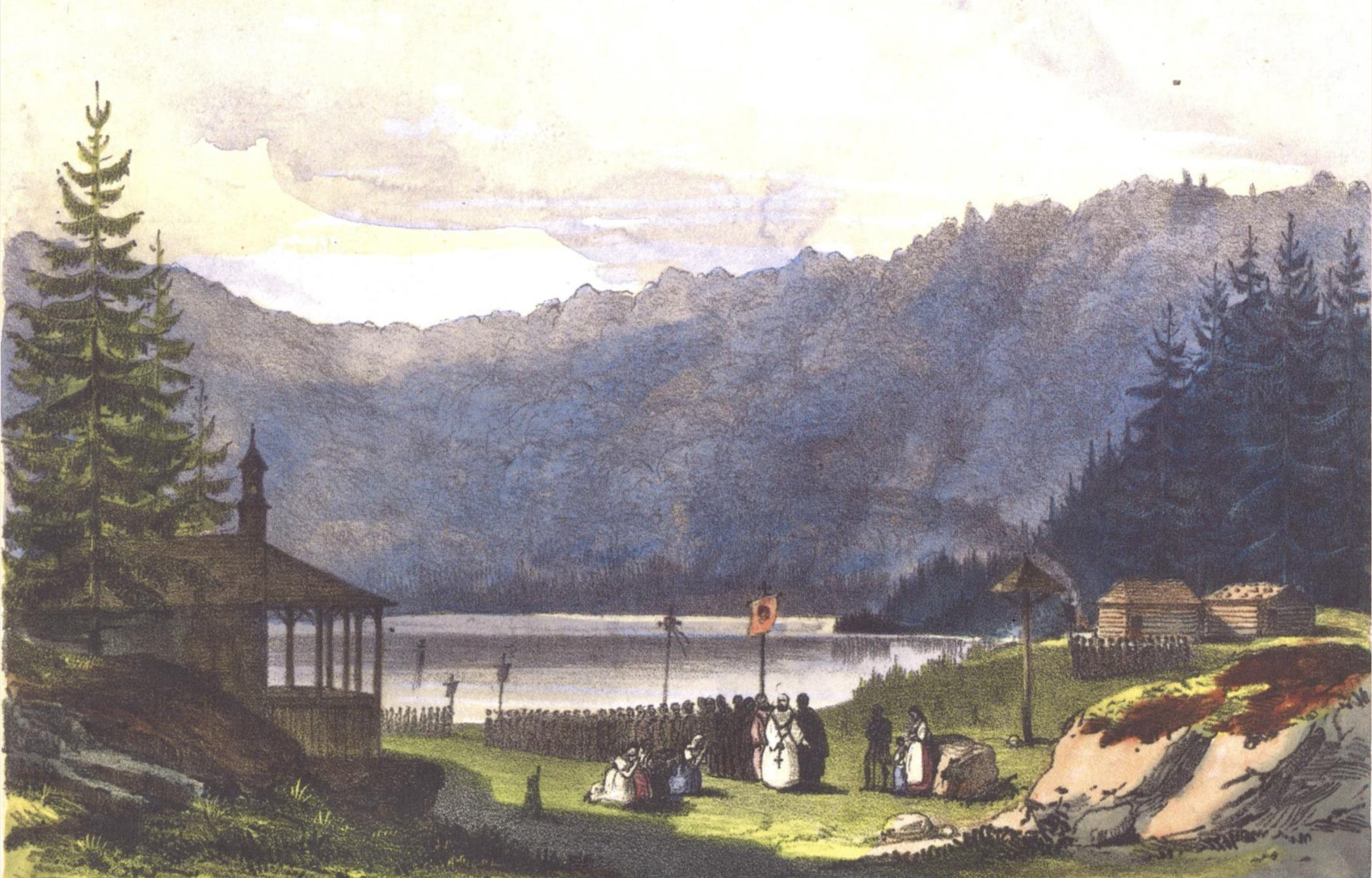
The mapping of Transylvania and the Bánság (Banat) was done between 1763 and 1773. As you can see in the image below, the first military map already shows a chapel on the lake’s shore, where the second one only writes “Ruine” [ruin], while on the third map the sign denoting a chapel (a cross) appears again. It is worth mentioning that before 1764, there was a wooden chapel by the lake, but then it was replaced with a stone chapel, where Szeklers from the region have gathered for a pilgrimage (“búcsú”) each year to celebrate Saint Anne.
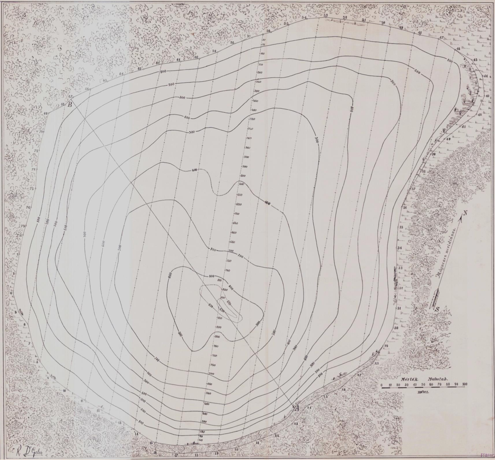
The shape of the lake resembles a palette. The first reliable set of data on the surface area was provided by zoologist József Gelei, a professor at the Geographic Institute of the Royal Hungarian Franz Joseph University (Kolozsvár) and member of the Hungarian Academy of Sciences. He found it measured 21.3 hectares in 1909, but 90 years later, geography students from Babeş-Bolyai University, Kolozsvár/Cluj Napoca, measured it again and came up with a different figure: 19.3 hectares, likely because of a fall in water level.
The first maximum-depth measurement known comes from the greatest Székely, Balázs Orbán, who dipped a 12.5 m long log from the ice into the lake. Gelei took the measurements a step further and provided the first bathymetric map in 1909. According to his findings, the maximum depth of the lake was between 8m and 9 m in 1909. In our days, specialists claim that the maximum depth of the lake is around 7–7.2 m. Fluctuations are due to intense ice and snow thawing, as a result of which water level can rise.
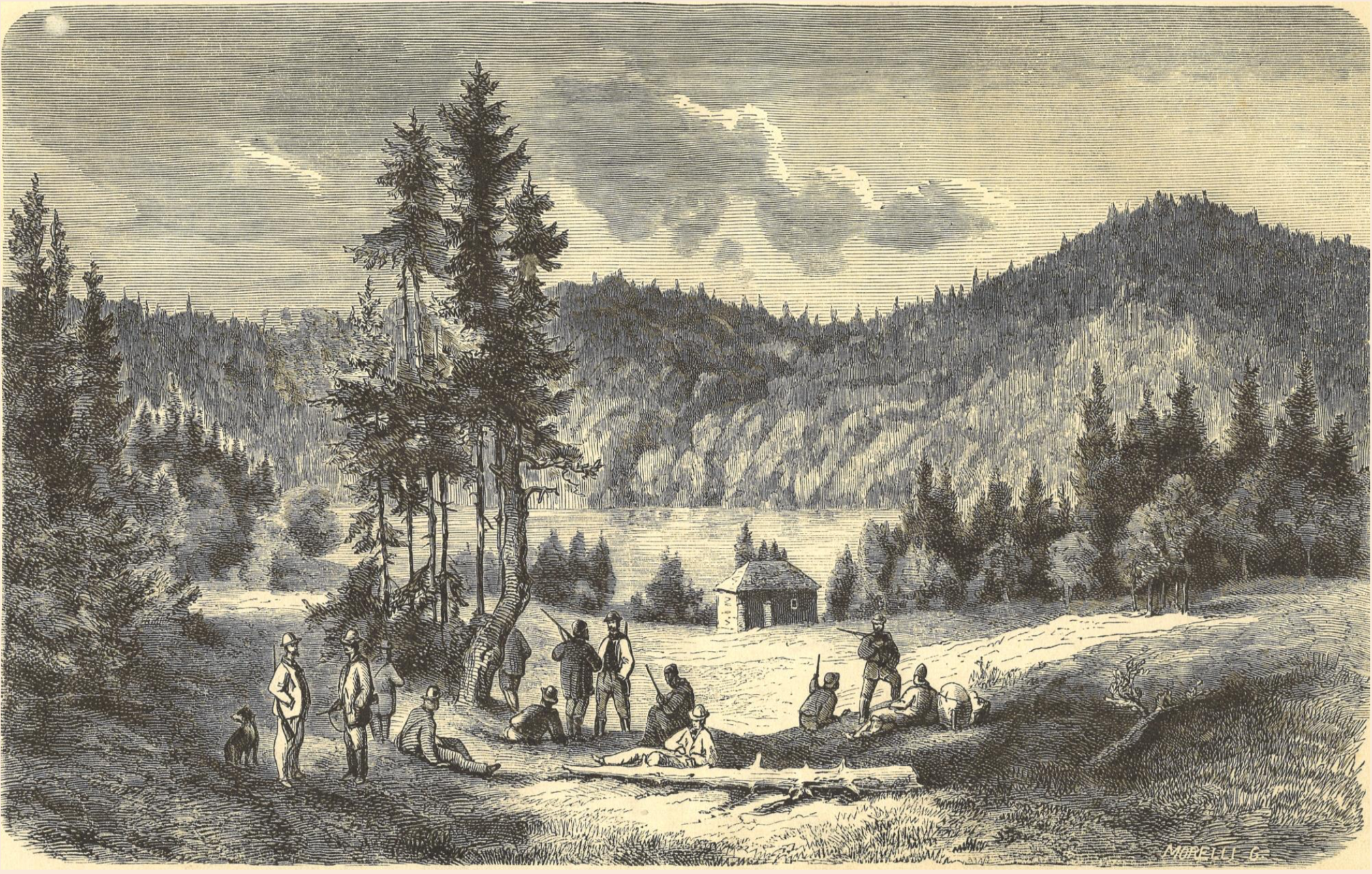
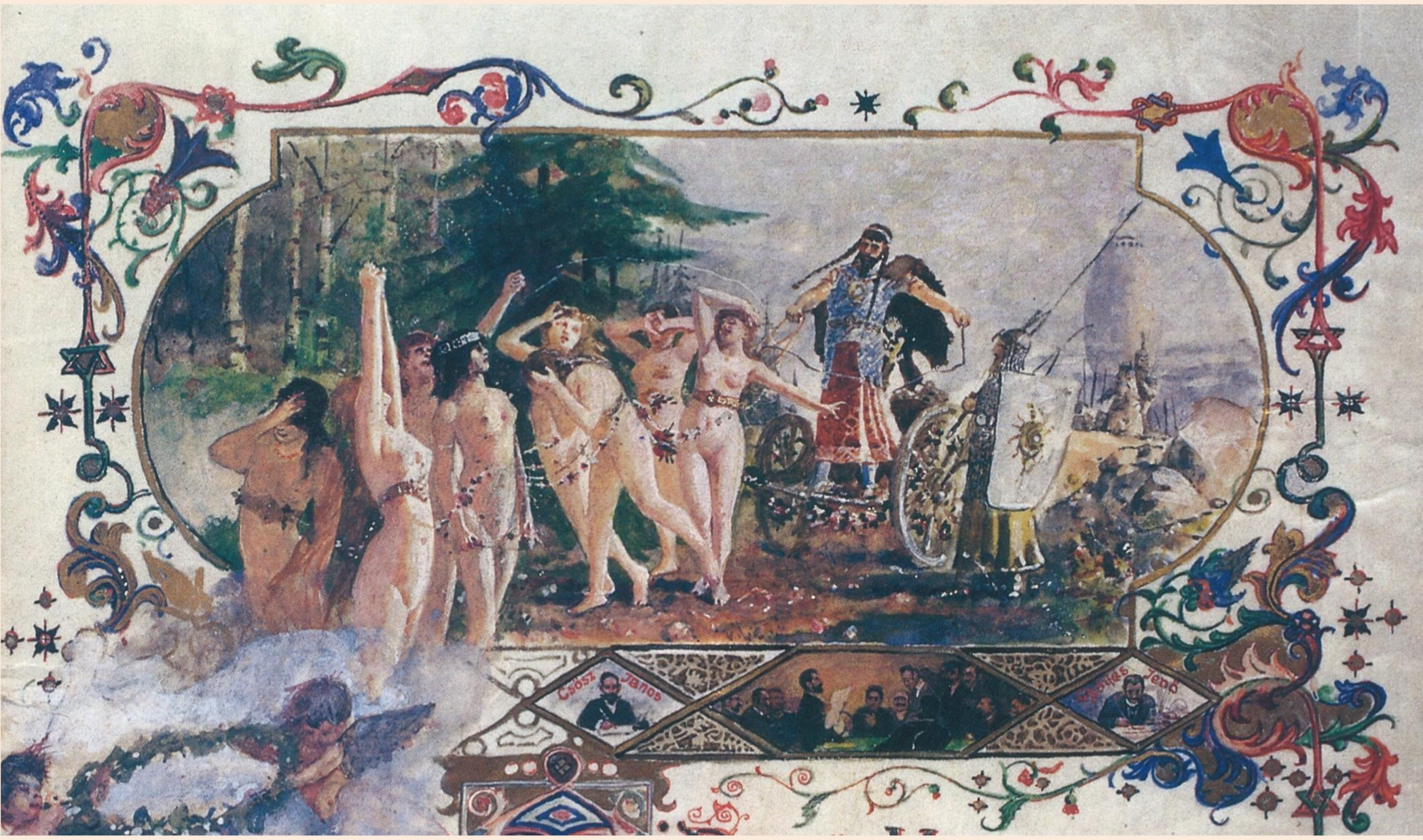
This pearl of Transylvania has inspired many authors, including renowned romantic writer Mór Jókai, who not only wrote about it but also painted it, as did painters such as Károly Szatmári Papp, Gusztáv Keleti, Győző Gyárfás (who painted himself into the picture), , and others, who painted this beautiful scenery and made this treasure popular both within the borders of the country and abroad.
This article is an excerpt of Sándor Tamás’s presentation about Lake Saint Anne. More details about this pearl of Transylvania can be found in the following book: Hunor Boér – Sándor Tamás: Szentanna. Kovászna Megyei Művelődési Központ – Székely Nemzeti Múzeum. Sepsiszentgyörgy, 2019.